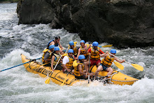
 The goal is to find bike paths that keep us away from the big highways and major roadways and make the way over to B'Ham with minimal interaction with traffic. Google maps is a good way to confirm bits and pieces of route information by being able to zoom in. I read many internet posts and blogs to look for ways to avoid traffic but didn't seem to find the route we ended up riding. Hence this blog post aims to share this 'gem of a ride' description as well as map for others to enjoy.
 Our route started in downtown Vancouver following the BC Parkway all the through Burnaby and New West. The route markers for BC Parkway could use an update. Half the challenge was route finding despite having a printout of the map with us. But bear with the map, stick to the path under the skytrain and you should be find yourself in New West just past the Edmonds train station. Then cross the Queensborough bridge onto Annacis Island and to hook up with the Alex Fraser Bridge into Delta.

If you have a Nexus pass, feel free to ride up to the Nexus lane to get through. Otherwise, follow the pedestrian cross walk instead of waiting in the car traffic to go inside the customs building for immigration.
Once past the border crossing, follow Peace Portal drive to Portal way and link up to Vista Drive. Vista Drive will get you to downtown Ferndale where you can cross the Nooksack River via a bridge. Main street in Ferndale will link to Pacific Hwy which runs roughly parallel to I-5 and can get you to Bellingham downtown.
It is a great ride which takes the better part of the day by the time you find the route. Total travel distance is about 100+ kM depending on how far into downtown Bellingham you are going. On long summer days, hit the road by 10 AM so you have lots of time to get to your destination. There is a 9 PM train back to Vancouver. But it is far more fun to kick up and relax at a B&B or hotel for one night or two and ride home.
Another great resource for bicycle route finding in the metro vancouver area is the UBC bicycle route planner. This is an interactive tool that clearly displays the grades of elevation change etc. All useful information for the novice/intermediate rider.
Logistics wise, we both ride 80's road bikes. We have Specialized Armadillo tires installed so we rarely get flats. The trails we rode were gravelly but okay for road bikes. Alternatively, a hybrid would work as well. Since most of the ride is a little away from commercial areas, it would be a good idea to bring along a pump and new tubes, just in case.
Enjoy the ride and feel free to share your story. Hope you will enjoy it as much as we did.